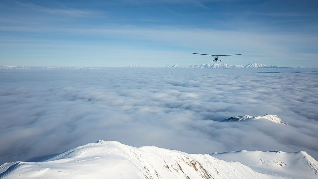
In winter, soaring becomes more exciting thanks to mountain waves and temperature inversions. When strong winds flow over mountain ranges, they create oscillations that can lift your glider high above terrain. Cold, dense air interacts with stable layers of warmer air above, forming inversions that enhance wave activity and turbulence. Recognizing these conditions helps you find smooth lift zones and avoid turbulence, boosting safety and performance. Continue exploring these phenomena to master winter soaring more confidently.
Key Takeaways
- Winter conditions often feature strong mountain waves and temperature inversions, creating ideal lift zones for soaring.
- Inversions stabilize the atmosphere, trapping cold air and amplifying mountain wave activity, increasing turbulence and lift.
- Recognizing cloud formations like lenticulars indicates strong wave activity and potential lift areas during winter flights.
- Stable layers caused by inversions enhance wave amplitude, offering consistent lift but also potential turbulence.
- Understanding these phenomena helps pilots optimize safety and performance while soaring in winter environments.
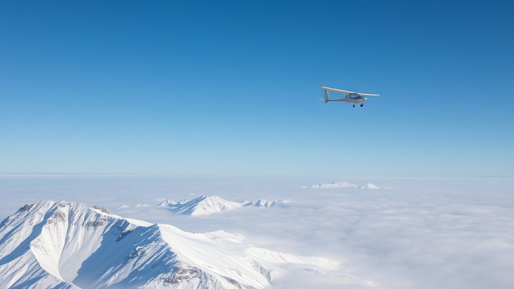
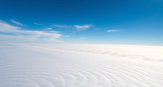
Wave lift and temperature inversion are key concepts in understanding atmospheric behavior and weather patterns. When you’re soaring through winter skies, recognizing how mountain waves and temperature layering influence your flight can make all the difference. Mountain waves occur when strong winds flow over mountain ranges, creating oscillations in the air that extend well above the peaks. These waves generate areas of rising air, which pilots often harness for smooth, sustained flight or gliding. As the wind hits the mountains, it’s forced upward, producing a series of wave-like motions that can extend miles downstream. This phenomenon is especially noticeable in winter, when the cold, dense air interacts with terrain, amplifying wave formation.
Temperature layering, or temperature inversion, plays a *vital* role in how these mountain waves behave. In a typical atmosphere, temperature decreases with altitude, but during an inversion, a layer of warmer air traps colder air beneath it. This inversion creates a stable environment that limits vertical mixing, causing the air to be stratified into distinct layers. When you encounter such a inversion, you’ll notice that the usual turbulence and cloud formations change dramatically. The stable layer acts like a lid, preventing warm air from rising and cold air from sinking, which enhances the formation of mountain waves. These waves can then produce dramatic lift zones where you might experience sudden, strong updrafts, making winter soaring both exciting and challenging.
Understanding the interplay between mountain waves and temperature layering helps you anticipate weather conditions better. During a temperature inversion, the stable layers can intensify mountain waves, leading to more pronounced lift or turbulence. This knowledge allows you to plan your flights around these phenomena, avoiding areas where strong wave activity might cause turbulence or, alternatively, seeking out these zones for a smooth ride. Recognizing the signs of temperature layering, such as unusual cloud formations or temperature changes with altitude, can alert you to the presence of mountain waves. Additionally, awareness of atmospheric stability and how it influences wave formation can improve your ability to predict lift zones and turbulence.
In winter, these atmospheric features are especially prominent, making it essential for pilots and gliders to understand how mountain waves interact with temperature inversions. By mastering these concepts, you gain insights into the atmospheric dynamics that influence your flight, helping you navigate safely and take advantage of the lift these natural processes offer. Whether you’re soaring for sport or simply exploring the winter skies, knowing how mountain waves and temperature layering work together will enhance your understanding of the environment and improve your flying experience.
As an affiliate, we earn on qualifying purchases.
Frequently Asked Questions
How Can Pilots Detect Wave Lift From the Cockpit?
You can detect wave lift from the cockpit by observing thermal turbulence and specific cloud formations. Look for lenticular clouds or wave clouds, which often indicate strong wave lift. Feel for sudden bumps or turbulence that signal rising air. Monitoring your variometer helps identify consistent lift, while cloud patterns and turbulence clues confirm wave activity. Staying alert to these signs allows you to leverage wave lift effectively during your flight.
What Are the Safety Risks Associated With Temperature Inversions?
Are you aware of the inversion hazards during winter soaring? Temperature inversions can trap moisture and pollutants, creating unstable air conditions that increase the risk of unexpected turbulence or loss of lift. As a pilot, you must maintain heightened awareness because inversion hazards can lead to disorientation or dangerous weather shifts. Recognizing these risks helps you make informed decisions, ensuring safety while exploiting wave lift safely.
Can Wave Lift Be Predicted With Weather Models?
Yes, wave lift can be predicted using weather models that incorporate wave forecasting and inversion dynamics. You should look for models that analyze upper-level wind patterns, temperature profiles, and stability indices, which help identify potential wave lift areas. Keep in mind that while predictions are generally accurate, local terrain and atmospheric conditions can introduce variability, so always combine model data with on-site observations for the best soaring experience.
How Do Temperature Inversions Affect Local Weather Patterns?
Temperature inversions trap cold air beneath warm layers, creating stable conditions that limit vertical movement. You’ll notice a stratospheric influence when warm air aloft suppresses surface cooling, impacting weather patterns. Urban heat can weaken inversions near cities, causing more variability in local weather. This stability often leads to fog, smog, or clear skies depending on the inversion’s strength, affecting your daily weather experience considerably.
Are There Specific Locations Best for Winter Soaring?
When it comes to winter soaring, it’s like hitting the jackpot if you’re near mountain valleys or coastal cliffs. These spots often trap warm air and create strong wave lift, perfect for gliding. You’ll find the best conditions when temperature inversions lock in the lift and keep the air stable. So, plan your flights around these terrain features for a safe and exhilarating winter soaring experience.
Conclusion
Now that you understand wave lift and temperature inversions, think of soaring through winter skies like riding a wave — smooth, powerful, and exhilarating. I once watched a pilot catch a perfect lift during a chilly morning, feeling like a surfer riding a giant swell. Just as surfers trust their wave knowledge, you can trust your understanding of these phenomena to glide effortlessly through winter thermals. Embrace the science, and your flights will become even more inspiring.