

Cloud streets form under specific conditions like stable atmospheres, temperature inversions, and strong wind and temperature gradients that align clouds into linear patterns. By understanding how wind dynamics, terrain effects, and cloud types influence their formation, you can better predict weather, improve aviation safety, and optimize renewable energy. Observing these patterns with satellite and radar technology helps exploit their potential effectively. Keep exploring this fascinating subject to discover how to harness these natural phenomena for your benefit.
Key Takeaways
- Cloud streets form under specific atmospheric conditions like temperature inversions and aerosol presence, aligning with wind patterns.
- Wind flow over terrain and temperature gradients organize cloud streets, influencing their orientation, stability, and visibility.
- Recognizing cloud types in streets helps predict weather patterns and climate impacts, such as precipitation and regional microclimates.
- Advanced remote sensing techniques enable real-time observation and analysis of cloud street formation and movement.
- Exploiting cloud street patterns enhances renewable energy strategies, optimizing wind turbine placement and improving weather forecasting accuracy.
The Atmospheric Conditions Leading to Cloud Street Formation

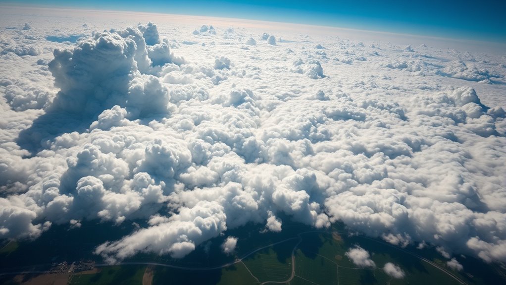
Cloud streets form when specific atmospheric conditions align, creating the perfect environment for these striking cloud patterns to develop. Aerosol effects play a significant role, as particles from pollution or natural sources influence cloud formation by providing nuclei for condensation. During nighttime occurrences, temperature inversions often stabilize the atmosphere, enabling cloud streets to stretch across the sky more distinctly. These conditions promote the alignment of convection currents, allowing warm, moist air to rise and cool steadily, forming elongated cloud bands. The combination of aerosol effects and stable, cooler nighttime air creates ideal conditions for cloud street development. Additionally, high-resolution satellite imagery helps scientists observe and analyze these cloud formations in real-time. Understanding these atmospheric factors helps explain why cloud streets are more prominent under certain circumstances, especially during the quiet, stable periods of the night.
The Role of Wind and Temperature Gradients in Cloud Alignment

Wind and temperature gradients are essential in shaping the alignment of cloud streets. These gradients influence aerodynamic interactions between airflow and the Earth’s surface, directing the flow patterns that form parallel cloud rows. When wind flows over uneven terrain or temperature differences exist, thermal convection occurs, creating rising and sinking air currents that organize into elongated structures. The stronger the wind gradient, the more aligned and persistent the cloud streets become. Temperature contrasts also affect the buoyancy of air parcels, reinforcing the convection patterns. As a result, these gradients work together to steer the formation of cloud streets, making their orientation predictable. Understanding these dynamics helps you anticipate the direction and stability of cloud streets, which can be exploited for weather insights and atmospheric studies. Aerosol interactions can further influence the formation and visibility of cloud streets under certain atmospheric conditions.
Types of Clouds Commonly Seen in Cloud Streets

You’ll often see different cloud types lining up in cloud streets, including cumulus and stratocumulus, which form in convective conditions. Lenticular clouds can also appear, shaped by wind flowing over mountains, while cirrus clouds stretch high in the sky, often indicating changing weather. Understanding these clouds helps you recognize the patterns and processes behind cloud street formations. Additionally, brewing methods can influence how clouds form in the atmosphere by affecting temperature and humidity levels.
Cumulus and Stratocumulus
Cumulus and stratocumulus clouds are the most common types you’ll see forming the striking rows known as cloud streets. These clouds originate through cloud pattern formation driven by atmospheric convection. Warm air rises from the surface, cools, and condenses into cloud formations, creating organized rows aligned with the wind direction. Cumulus clouds are typically puffy and well-defined, signaling active convection, while stratocumulus clouds tend to be layered and more extensive, indicating a more stable atmosphere. Both types can participate in cloud street formation when the conditions favor consistent wind shear and temperature gradients. Recognizing these cloud types helps you understand the underlying atmospheric processes and anticipate the development of cloud streets in different weather scenarios. Understanding cloud formation enhances the ability to interpret weather patterns and predict cloud street development more accurately.
Lenticular and Cirrus
Have you ever noticed the striking, lens-shaped clouds that often appear aligned in rows across the sky? Those are lenticular clouds, known for their smooth, saucer-like shapes, forming when moist air flows over mountains, creating stable, standing waves. They’re common in cloud streets and signal strong atmospheric stability. Cirrus formations, on the other hand, are wispy, high-altitude clouds made of ice crystals. They often appear as delicate, feathery streaks that drift across the sky, sometimes indicating an approaching weather front. Both lenticular clouds and cirrus formations play roles in cloud street patterns, revealing wind patterns and atmospheric conditions. Recognizing these cloud types helps you interpret weather cues and understand the dynamic processes shaping the sky’s landscape.
How Cloud Streets Affect Local Weather Patterns and Climate

Cloud streets align with local wind patterns, influencing how air moves and mixes in the atmosphere. They can also shift precipitation zones, affecting where rain or snow falls. Over time, these patterns may have broader effects on regional climate and weather stability. Additionally, the formation and movement of cloud streets can be impacted by skincare patches, which alter surface conditions and local airflow.
Cloud Streets and Wind
When wind interacts with the organized rows of clouds known as cloud streets, it can profoundly influence local weather patterns and climate. These patterns can either enhance or disrupt maritime navigation, as steady wind flows along cloud streets can signal stable conditions or impending changes. In urban areas, cloud streets can affect the distribution of heat, intensifying urban heat islands by trapping warm air beneath the cloud formations. The alignment of cloud streets with prevailing winds can also modify local wind speeds and directions, impacting everything from small-scale weather to regional climate. Recognizing how wind shapes these cloud formations helps you better understand atmospheric stability and forecast conditions that influence daily life, shipping routes, and climate trends. Additionally, Hackathons can foster innovative solutions for climate monitoring technologies, enabling better prediction and management of weather phenomena like cloud streets.
Impact on Precipitation Patterns
The presence of cloud streets can considerably influence local precipitation patterns by directing moisture and air flows in the atmosphere. These organized cloud formations shape moisture distribution, often enhancing or suppressing rainfall depending on their orientation and stability. Cloud microphysics plays a key role, as the interaction of water droplets within the streets affects how quickly and intensely precipitation develops. When cloud streets align with prevailing winds, they can channel moisture into specific areas, increasing rainfall. Conversely, they can also act as barriers, limiting moisture flow. This pattern impacts localized weather, influencing droughts or floods. Below is a table illustrating these effects:
| Effect | Result |
|---|---|
| Moisture channeling | Increased localized rainfall |
| Suppressed convection | Reduced precipitation in certain areas |
| Cloud microphysics | Alters rainfall intensity and timing |
| Wind alignment | Directs moisture flow, shaping weather patterns |
| Stability of streets | Determines if rainfall is enhanced or suppressed |
Climate Implications
Cloud streets can markedly influence local weather patterns and, over time, impact broader climate conditions. They affect urban heat by creating areas of increased or decreased temperature, influencing city microclimates. Over the ocean, cloud streets reinforce marine stratification, stabilizing surface waters and affecting heat exchange between the sea and atmosphere. This can alter regional climate patterns by modifying wind patterns and cloud cover. As cloud streets persist, they can contribute to feedback loops that amplify warming or cooling trends. By shaping how heat is distributed locally and across larger regions, cloud streets play a vital role in climate dynamics. Recognizing their influence helps you better understand how small-scale cloud formations can have significant, long-term climate implications. Additionally, the formation and persistence of cloud streets are influenced by aerosol concentrations which can modify cloud properties and their effects on regional weather.
Techniques for Observing and Predicting Cloud Streets

Advancements in remote sensing technologies have considerably improved how you observe and predict cloud streets. Satellite imaging allows you to capture high-resolution images of cloud formations from space, revealing intricate patterns and their evolution over time. This provides critical data on the spatial extent and orientation of cloud streets. This technological progress aligns with remote work principles, offering increased flexibility and efficiency in atmospheric monitoring. Radar detection complements this by tracking cloud movement and vertical development, offering real-time insights into atmospheric dynamics. Together, these tools enable you to monitor current conditions accurately and identify the early stages of cloud street formation. By analyzing satellite images and radar data, you can better understand the factors influencing cloud street development and improve forecasting models. These techniques make predicting the appearance and behavior of cloud streets more precise and reliable.
Practical Applications: Enhancing Weather Forecasts and Aviation Safety

By leveraging detailed observations of cloud streets, meteorologists can considerably improve weather forecasts and enhance aviation safety. Recognizing patterns helps in predicting local wind conditions and turbulence, vital for flight planning. Aerosol interactions influence cloud chemistry, affecting cloud formation and stability, which in turn impacts weather models. Understanding these processes allows for more accurate predictions of storm development and cloud behavior. Additionally, studying cloud patterns can reveal insights into changing climate conditions and long-term atmospheric trends.
Harnessing Cloud Streets for Renewable Energy Optimization
Harnessing the organized patterns of cloud streets offers a promising avenue for optimizing renewable energy sources, particularly wind and solar power. By analyzing cloud street formations, you can better predict wind flow patterns, enabling more precise wind turbine placement and improved efficiency. Additionally, understanding how cloud streets influence solar panel alignment helps maximize sunlight exposure, boosting solar energy output. Recognizing the impact of urban heat islands is also vital, as they can disrupt local cloud patterns and wind flows, affecting energy generation. You can leverage this knowledge to design smarter, adaptive energy systems that respond to atmospheric conditions. Employing advanced monitoring technology can further enhance the accuracy of cloud pattern analysis, leading to more effective energy management. Overall, exploiting cloud street dynamics enhances the reliability and efficiency of renewable energy installations, helping you harness natural patterns for sustainable power production.
Frequently Asked Questions
How Do Cloud Streets Influence Long-Term Climate Change?
Cloud streets impact long-term climate change by affecting aerosol effects and cloud radiative forcing. You should know that these formations influence how sunlight is reflected or absorbed, altering Earth’s energy balance. They can either cool or warm the planet based on their properties. Understanding their role helps you grasp how natural processes and human activities, like pollution, modify cloud behavior, ultimately shaping climate patterns over time.
Can Cloud Streets Be Used to Predict Severe Weather Events?
You can use satellite imagery and wind shear data to help predict severe weather events related to cloud streets. When you analyze these images, look for specific cloud patterns that indicate instability. Wind shear influences the formation and development of cloud streets, giving clues about potential storms. By monitoring these signs, you better anticipate severe weather, making your forecasts more accurate and timely.
What Is the Impact of Pollution on Cloud Street Formation?
Imagine pollution effects as adding more paint to a canvas, changing the picture’s details. Pollution can disrupt cloud formation by introducing particles that act as condensation nuclei, leading to irregular or less organized cloud streets. This interference can weaken the natural patterns you’d see in cloud streets, making them less predictable. So, pollution fundamentally alters the environment where these atmospheric features develop, impacting their formation and appearance.
Are There Geographic Regions More Prone to Developing Cloud Streets?
You’ll find that certain geographic regions are more prone to developing cloud streets due to regional climate and geographic variability. Coastal areas, especially over oceans or large lakes, often see more cloud street formations because of temperature contrasts and airflow patterns. Also, flat terrains with minimal obstructions promote their formation. By understanding these regional climate influences, you can better predict where cloud streets are likely to occur and leverage this knowledge for weather insights.
How Do Cloud Streets Interact With Atmospheric Pollution Dispersion?
You might notice that cloud streets can influence pollution dispersion by interacting with aerosols. They can trap pollutants through aerosol interactions, creating zones where pollution concentrates. This process can either help clear the air or worsen local air quality, depending on wind conditions and cloud structure. Understanding how cloud streets trap pollution enables you to predict pollution hotspots and improve air quality management strategies.
Conclusion
By understanding cloud streets, you unlock the sky’s hidden choreography—rows of shimmering clouds stretching like nature’s own highway. As you watch their graceful alignment dance across the horizon, you gain insight into the atmosphere’s secrets. Harness this knowledge to improve weather forecasts, boost aviation safety, and optimize renewable energy. So next time you see those parallel cloud lines, remember: you’re witnessing a dynamic, living pattern that holds the key to revealing the sky’s endless mysteries.