

To time your launch perfectly, monitor the formation of sea-breeze fronts by observing temperature differences, wind shifts, and cloud patterns along the coast. Keep an eye on tide cycles, as high tides can delay the front’s inland movement and fog development, while low tides speed it up. Tracking satellite images and weather updates will improve timing accuracy. Stay informed about these indicators, and you’ll better anticipate the ideal window for your coastal operation. If you continue exploring, you’ll discover more tips to optimize your launch timing.
Key Takeaways
- Monitor tide cycles; high tides can delay sea-breeze front inland movement, affecting launch timing.
- Use satellite imagery and Doppler radar to track front progression and anticipate ideal conditions.
- Observe wind shifts and cloud formations for early signs of the front’s approach and optimal windows.
- Check local weather forecasts for humidity, wind speed, and fog, which influence safety and timing.
- Coordinate observational data with models to predict precise arrival times and plan launches accordingly.
Understanding the Formation of Sea-Breeze Fronts

Sea-breeze fronts form when the temperature difference between the cool ocean air and the warmer land surface becomes significant enough to trigger a sharp boundary. This boundary influences marine ecology by affecting local wind patterns and water temperatures, which can impact marine life and ecosystems. As the front advances inland, it often leads to changes in humidity and wind speed, shaping coastal conditions. These dynamics also play a role in coastal erosion, as increased wind and wave activity can wear away shorelines over time. Understanding how sea-breeze fronts develop helps you anticipate shifts in coastal environments and marine habitats. Recognizing this formation process allows you to better evaluate the environmental impacts and prepare for potential changes caused by these natural phenomena. Additionally, weather patterns associated with sea-breeze fronts can be highly localized, affecting weather forecasts and maritime operations in coastal areas.
Key Indicators of an Approaching Sea-Breeze Front

As the temperature difference between the ocean and land widens, certain atmospheric signs signal an approaching sea-breeze front. You’ll notice changes in tide cycles, often with a noticeable shift in water levels as the breeze influences coastal waters. Marine traffic also offers clues; boats and ships tend to alter their routes or slow down as the front nears, reacting to shifting winds and changing weather conditions. Additionally, you might observe a cooling breeze developing along the shoreline, accompanied by a noticeable drop in humidity. Cloud formations can become more stratified or develop a distinct line parallel to the coast. These indicators, combined with tide and marine activity, help you anticipate the front’s arrival and time your launch more effectively. Recognizing atmospheric conditions such as temperature gradients and wind patterns can further improve your timing accuracy.
The Impact of Sea-Breeze Fronts on Weather Conditions

When a sea-breeze front passes, you’ll notice quick temperature drops and gusty winds. These fronts also cause clouds to form more rapidly, changing the sky’s appearance. Understanding these effects helps you anticipate shifts in weather conditions more accurately. Recognizing the signs of sea-breeze fronts can also aid in weather forecasting and planning outdoor activities accordingly.
Temperature Fluctuations
Temperature fluctuations caused by sea-breeze fronts can be sudden and noticeable, considerably impacting local weather conditions. As the front advances, it disrupts the balance of solar radiation, often causing rapid cooling or warming in the area. When the sea breeze moves inland, it brings cooler, moist air, lowering temperatures quickly. Conversely, as the front retreats, temperatures can spike as the land warms again. Humidity levels also shift sharply, increasing as moist air from the sea replaces drier inland air. These fluctuations can catch you off guard, especially if you’re timing a launch or outdoor activity. Understanding how sea-breeze fronts influence temperature helps you anticipate sudden changes, ensuring you’re better prepared for the unpredictable variations in weather conditions. Additionally, AI automation can assist in forecasting these rapid weather changes more accurately, helping you plan accordingly.
Wind Speed Changes
Sea-breeze fronts can cause significant changes in wind speed, often catching you off guard. As the front approaches, you’ll notice sudden wind speed fluctuations, with gusts intensifying rapidly. These shifts can disrupt your plans if you’re unprepared, so staying alert is key. During a sea-breeze front, gust intensity varies sharply, sometimes reaching high velocities in seconds. To illustrate, consider this table:
| Wind Condition | Description |
|---|---|
| Calm | Light, steady breeze |
| Gusty Fluctuations | Sudden, sharp increases in wind speed |
| Strong Gusts | High-intensity gusts, risking stability |
Recognizing these patterns helps you anticipate changes, ensuring safer launches and better decision-making amid fluctuating conditions. Monitoring weather patterns can provide additional insights to better prepare for these rapid wind changes.
Cloud Formation Effects
Have you ever noticed how clouds suddenly thicken or change shape as a sea-breeze front approaches? This shift often leads to increased cloud cover, sometimes obscuring the sky completely. As the front advances, warm, moist air from the ocean rises and cools rapidly, causing condensation. This process can trigger fog development near the coast, reducing visibility and complicating launch plans. The cloud formation effects are immediate and noticeable, often signaling an impending change in weather conditions. Recognizing these cloud formation effects helps you anticipate weather changes, ensuring you time your activities, like launches, safely and effectively. Additionally, understanding natural elements can aid in predicting weather patterns more accurately.
Strategies for Monitoring and Predicting Sea-Breeze Fronts

Monitoring and predicting sea-breeze fronts require a combination of observational techniques and advanced modeling approaches. You should start by analyzing weather data, focusing on marine fog patterns, which often signal approaching fronts. Satellite imagery and Doppler radar help identify the front’s position and movement in real time. Pay attention to the tidal influence, as higher tides can intensify sea breezes and alter front behavior. Surface weather stations provide vital temperature, humidity, and wind data, supporting forecasts. Combining these observations with numerical models improves accuracy, enabling you to anticipate the front’s arrival more precisely. Incorporating air quality indicators can also enhance understanding of atmospheric conditions that influence sea-breeze behavior. By integrating observational insights with predictive tools, you can develop reliable strategies to time your launch effectively, reducing risks associated with sudden weather changes.
Optimal Timing for Launches Relative to Sea-Breeze Fronts

Choosing the right weather window is essential for timing your launch effectively. You need to understand how sea-breeze fronts move and change throughout the day. By doing so, you can plan your launch to minimize risks and maximize success. Additionally, monitoring regional weather patterns can provide valuable insights into local conditions affecting sea-breeze fronts.
Weather Window Selection
Timing your launches around sea-breeze fronts is crucial to guarantee safety and ideal performance. Selecting the right weather window ensures your operations don’t disrupt marine ecology or coastal tourism. Look for stable conditions with clear skies, light winds, and minimal cloud cover, signaling a predictable sea breeze pattern. Pay attention to local forecasts and real-time weather data to identify the best launch times. A well-chosen window minimizes risks caused by sudden gusts or storm development, preserving safety and project success. Use this table to compare different conditions:
| Condition | Effect on Launch | Best for |
|---|---|---|
| Calm, clear skies | Stable, predictable front | Safe, precise launches |
| Light winds | Less turbulence | Smooth operations |
| Overcast, storm risk | Unpredictable, dangerous | Avoid, wait for better window |
| High humidity | Potential fog, delays | Plan accordingly |
Additionally, understanding weather patterns can help anticipate changes and optimize launch timing.
Front Movement Patterns
Have you ever wondered how the movement of the sea-breeze front affects your launch schedule? The front moves inland during the day, driven by temperature differences, but its pattern can vary with tide influence. During high tide, the marine fog often lingers longer, slowing the front’s progression and causing delays. Conversely, low tide tends to accelerate its inland movement, creating a quicker passage from morning calm to afternoon wind. Recognizing these movement patterns helps you anticipate the front’s position and timing your launch more accurately. Monitoring tide cycles and marine fog conditions allows you to predict whether the front will move swiftly or stall, ensuring you choose the most suitable moment for a safe, efficient launch aligned with the front’s behavior. Utilizing knowledge of sea-breeze front patterns can further enhance your timing strategies by providing insights into how environmental factors influence front movement.
Practical Tips for Safe and Successful Coastal Operations
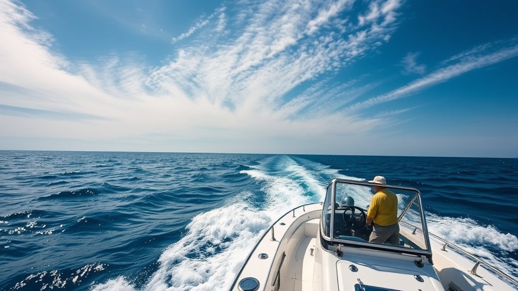
Traveling through coastal regions influenced by sea-breeze fronts demands careful planning and vigilance. Always check local weather forecasts and be aware of front timing to avoid sudden changes in wind and visibility. Use reliable marine navigation tools to track your position accurately, especially near areas prone to coastal erosion, which can alter shoreline features unexpectedly. Maintain a close watch on wind shifts, as they can affect vessel control and safety. Communicate your plans with your team and establish clear emergency procedures. Keep an eye on tide charts, as rising or falling water levels combined with sea-breeze activity can impact launching and landing. By staying alert and prepared, you minimize risks and ensure a safe, successful operation along the coast.
Frequently Asked Questions
How Far in Advance Can Sea-Breeze Fronts Be Reliably Predicted?
You can typically rely on forecast accuracy for sea-breeze fronts within prediction windows of about 6 to 12 hours. Longer-term predictions become less precise due to variable meteorological factors. By monitoring updates from weather models and radar, you can better anticipate the front’s arrival. Planning your launch within this window helps guarantee ideal timing, reducing the risk of unexpected weather changes impacting your activities.
Do Sea-Breeze Fronts Affect Maritime Navigation Safety?
Sea-breeze fronts can considerably impact maritime safety by altering weather patterns suddenly, making navigation more challenging. When these fronts develop, they often bring gusty winds, sudden shifts in wind direction, and changing sea conditions, which can catch mariners off guard. Staying aware of weather forecasts and monitoring real-time weather updates help you anticipate these effects, ensuring safer navigation and better preparedness against unpredictable sea-breeze front developments.
Are There Specific Locations More Prone to Early Sea-Breeze Front Formation?
You’ll find that locations with varied local topography and significant urban heat tend to be more prone to early sea-breeze front formation. Coastal areas with hills, valleys, or urban heat islands create temperature differences that trigger sea breezes sooner. By paying attention to these factors, you can better anticipate early sea-breeze fronts, helping you plan safer and more efficient maritime operations. Always monitor local weather patterns for ideal timing.
How Do Sea-Breeze Fronts Influence Coastal Ecosystem Activities?
Jumping into the deep end, sea-breeze fronts markedly impact coastal ecosystems. You’ll notice they trigger morning fog and cooler temperatures, which influence coastal flora by reducing heat stress. They also guide animal migration, helping species navigate and find food or breeding grounds. These fronts act like nature’s air traffic controller, maintaining a delicate balance in coastal environments and supporting biodiversity by creating ideal conditions for various species.
Can Climate Change Alter the Timing or Intensity of Sea-Breeze Fronts?
Climate change can definitely alter the timing and intensity of sea-breeze fronts. You’ll notice climate variability shifting atmospheric patterns, which influence when these fronts develop and how strong they become. As global temperatures rise, these changes may lead to more unpredictable or intense sea-breeze events, affecting local weather and ecosystems. Staying aware of these shifts helps you better understand how climate impacts coastal environments and plan accordingly.
Conclusion
By understanding sea-breeze fronts, you can time your launches like a skilled sailor catching the perfect wave. Keep an eye on key indicators and monitor weather changes closely, so you’re not caught off guard. Planning around these fronts is like steering through a busy harbor—you need precision and awareness. With these strategies, you’ll stay safe and make the most of your coastal operations, turning unpredictable weather into an advantage rather than a hurdle.