

A Skew‑T chart helps you quickly analyze weather by showing temperature, dew point, and wind data at various altitudes. You’ll identify turbulence, wind shear, and cloud formation by observing how these lines and wind barbs change with height. Recognizing features like temperature inversions or jet streams helps you plan for hazards and adjust your route or altitude accordingly. Continue exploring to master how these charts enhance your flight safety and decision-making.
Key Takeaways
- Understand the components of a skew-T chart, including temperature, dew point, and wind data at various altitudes.
- Learn to identify wind shear by analyzing wind barbs, arrows, and changes in wind speed and direction with height.
- Recognize signs of turbulence and hazards such as sharp temperature shifts, dense wind barbs, and layered cloud formations.
- Use temperature and dew point lines to assess stability, cloud types, and potential icing conditions before flight.
- Review the chart early to plan routes and altitude adjustments, focusing on turbulence, wind shear, and icing risks for safety.
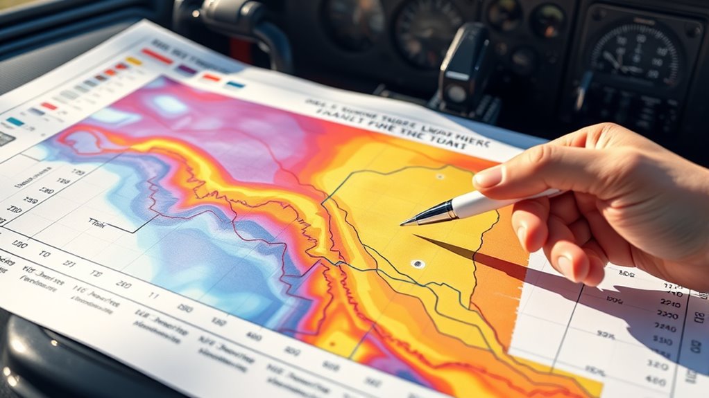
Skew T chart interpretation guide
As an affiliate, we earn on qualifying purchases.
As an affiliate, we earn on qualifying purchases.
Understanding the Components of a Skew‑T Chart

To understand a Skew‑T chart, it’s essential to familiarize yourself with its key components. The chart displays temperature, dew point, and wind data at various altitudes, helping you analyze atmospheric conditions. Wind shear appears on the chart as variations in wind direction and speed with height, which can be crucial for flight safety. Notice the wind barbs and arrows that indicate wind speed and direction, helping you spot areas where wind shear might occur. The jet stream is often visible as a narrow band of strong winds at high altitudes, shown by tightly packed wind barbs. Recognizing these features allows you to anticipate turbulence and wind changes, making your understanding of the Skew‑T chart indispensable for safe and efficient flight planning.
aviation weather analysis tools
As an affiliate, we earn on qualifying purchases.
As an affiliate, we earn on qualifying purchases.
Reading Temperature and Dew Point Lines

Have you ever wondered how to quickly interpret the temperature and dew point lines on a Skew‑T chart? These lines reveal essential info about atmospheric moisture and stability, affecting your flight planning. To read them effectively:
- Visualize the temperature line slanting across the chart, showing the current air temperature at different altitudes.
- Notice where the dew point line converges with the temperature line—indicating high humidity and potential cloud formation.
- Observe how these lines behave near wind shear zones, possibly signaling turbulence.
- Recognize mountain wave patterns, where temperature and dew point lines shift sharply, hinting at turbulence and wind shifts.
- Understanding the contrast ratio can help you better interpret the visual clarity of cloud formations depicted on the chart, enhancing your situational awareness.
Understanding these lines helps you anticipate weather phenomena like mountain waves or wind shear, ensuring safer, more informed flying decisions.
pilot weather chart viewer
As an affiliate, we earn on qualifying purchases.
As an affiliate, we earn on qualifying purchases.
Interpreting Stability and Cloud Formation

Understanding atmospheric stability on a Skew‑T chart helps you predict cloud formation and weather conditions. Stable conditions, shown by a temperature line remaining close to the dew point, indicate little vertical movement, leading to minimal cloud development. Conversely, unstable conditions, where the temperature decreases rapidly with height, signal potential for towering clouds and thunderstorms. Wind shear, indicated by changing wind direction or speed with altitude, can enhance turbulence and impact cloud growth. If the temperature profile suggests instability near freezing levels, icing conditions are likely, especially if supercooled liquid droplets are present. Recognizing these signs helps you anticipate cloud types, turbulence, and potential icing hazards, enabling safer flight planning and better situational awareness. Additionally, understanding the concept of atmospheric stability can help pilots interpret the likelihood of convection and storm development.
flight planning weather instruments
As an affiliate, we earn on qualifying purchases.
As an affiliate, we earn on qualifying purchases.
Identifying Turbulence and Weather Hazards

When analyzing a Skew‑T chart for turbulence and weather hazards, look for signs of wind shear, such as rapid changes in wind direction or speed with altitude. Wind shear often appears where wind barbs on the chart show sudden shifts or variations over a short vertical distance. Pay close attention to areas with tightly packed wind barbs, indicating strong winds and potential turbulence. Also, watch for temperature inversions or unstable layers that can cause turbulent air. Rapid changes in wind speed or direction are key indicators of hazardous conditions. Visual cues include:
- Sharp turns or clusters of wind barbs indicating wind shear
- Sudden temperature drops or inversions
- Areas of high wind speeds with dense wind barbs
- Layered clouds signaling instability and turbulence potential
Additionally, understanding how creative practice involves embracing failure and experimenting can help pilots approach uncertain weather conditions with a resilient mindset, fostering better decision-making under pressure. These signs help you anticipate turbulence and weather hazards before flight.
Practical Tips for Using Skew‑T Charts Before Flight
To effectively use Skew‑T charts before your flight, start by reviewing the chart early enough to identify potential turbulence and weather hazards. Look for signs of icing hazards, such as areas with high moisture content and temperatures near freezing, which can indicate icing risk. Pay close attention to temperature and dew point lines to assess where icing might develop. Also, monitor for wind shear zones, often found near frontal boundaries or jet streams, which can cause sudden changes in wind speed and direction. Recognizing these signs helps you plan your route or altitude adjustments to avoid hazardous conditions. Additionally, understanding sensitive weather conditions such as rapid temperature changes and moisture levels can further enhance your safety and situational awareness, ensuring a smoother, more confident flight.
Frequently Asked Questions
How Often Should Pilots Update Skew-T Analyses Before Flight?
You should update your skew-T analyses regularly before each flight to guarantee accurate weather pattern assessment. Weather patterns can change quickly, affecting cloud layers and stability. Relying on recent data helps maintain chart accuracy, especially when planning for potential hazards. Typically, update your skew-T analysis within an hour of departure, but if the weather is changing rapidly, check again closer to flight time to stay current and safe.
Can Skew-T Charts Predict Specific Turbulence Intensities?
Think of skew‑T charts as weather pattern detectives, but they can’t promise the exact outcome. You can’t rely on them to predict specific turbulence intensities precisely; instead, they give a good sense of potential areas of turbulence. While they improve forecast accuracy, turbulence can vary due to changing weather patterns. Use skew‑T charts as a helpful tool, but always be prepared for surprises during your flight.
Are There Digital Tools to Simplify Skew-T Interpretation?
You wonder if automation tools can simplify skew-T interpretation. The good news is that many digital data visualization tools are available, making it easier to analyze these charts quickly and accurately. These tools automate complex calculations, highlight key temperature and dew point trends, and help you identify weather patterns efficiently. By using automation, you can focus more on decision-making and flight safety, easing the learning curve and reducing errors.
How Do Seasonal Changes Affect Skew-T Chart Readings?
You might think seasonal variations don’t impact skew‑T charts, but they actually influence temperature gradients and humidity levels markedly. During winter, colder temperatures and steeper temperature gradients can make stability indices more critical, while summer shows more gradual changes. These fluctuations affect how you interpret the chart, so understanding seasonal effects helps you anticipate weather patterns and make safer flying decisions, especially when evaluating potential turbulence or cloud formation.
What Are Common Mistakes to Avoid When Reading a Skew-T Chart?
When reading a skew‑T chart, avoid misreading axes to guarantee accurate data interpretation. Don’t ignore wind shear, as it can considerably impact flight safety. Always double-check temperature and dew point lines for clarity, and pay attention to the wind barbs. By staying alert to these common mistakes, you help prevent misjudging atmospheric conditions that could affect your flight planning and safety.
Conclusion
Mastering skew‑T charts might seem daunting at first, but with practice, you’ll see the fog lift. Remember, the devil is in the details—pay close attention to temperature and dew point lines, and you’ll access valuable insights for your flight. Don’t let the charts be a thorn in your side; instead, use them as your trusty compass. With time, these tools will become second nature, helping you fly safer and smarter every time.