

Your understanding of air mass stability shows that when the air is stable, vertical cloud development is limited, leading to thin, layered clouds like stratus. Conversely, unstable air encourages vertical movement, forming cumulus and storm clouds such as cumulonimbus. Factors like temperature differences, moisture, and atmospheric disturbances play key roles in this process. If you’d like to explore how these elements interact further, you’ll find more detailed insights as you continue.
Key Takeaways
- Stable air resists vertical movement, leading to thin, layered clouds like stratus, with minimal vertical development.
- Unstable air promotes upward movement of moist air, resulting in cumulus and cumulonimbus clouds with vertical growth.
- Disturbances such as fronts or heating trigger vertical ascent, increasing cloud formation and potential storm development.
- Temperature differences, especially surface heating, destabilize the air mass, encouraging convection and cloud growth.
- Higher atmospheric moisture combined with instability enhances cloud development and the likelihood of storm clouds forming.

Understanding how air mass stability influences cloud development is essential for predicting weather patterns. When you observe the sky, you’re seeing the results of complex interactions within the atmosphere, especially how air masses behave. The stability of an air mass determines whether clouds will form and, if so, what types of clouds appear. Stable air resists vertical movement, meaning it’s less likely to produce significant cloud formation. Conversely, unstable air encourages rising air parcels, which can lead to the development of various cloud types and potentially stormy weather. Atmospheric disturbances, such as fronts or localized heating, disrupt the equilibrium, making the atmosphere more prone to instability. These disturbances can trigger the vertical ascent of moist air, leading to cloud formation.
If you’re tracking weather, understanding the stability of the air mass helps you anticipate cloud development. In stable conditions, the air remains stratified, and clouds tend to stay shallow, often forming as smooth, layered stratus clouds. These clouds usually bring overcast skies but minimal precipitation. On the other hand, when the atmosphere becomes unstable due to disturbances, you’ll likely see cumulus clouds grow vertically. This vertical growth indicates strong upward motion, which can develop into cumulonimbus clouds, often associated with thunderstorms and heavy rainfall. The key factor here is how atmospheric disturbances disturb the balance of the air mass, allowing moist air to rise freely and cool, resulting in cloud formation.
The temperature difference between the air and the surface plays a pivotal role as well. Warm, moist air near the surface is more prone to instability if it’s overlain by cooler, denser air aloft. This temperature gradient encourages convection, further enhancing cloud development. You’ll notice that during the daytime, surface heating often destabilizes the air mass, leading to increased cloud formation and sometimes storm activity. Conversely, during cooler periods or in stable conditions, cloud formation becomes limited, and the sky remains clearer. Additionally, the air mass’s stability can be influenced by the presence of atmospheric moisture, which provides the necessary humidity for cloud formation when conditions become unstable.
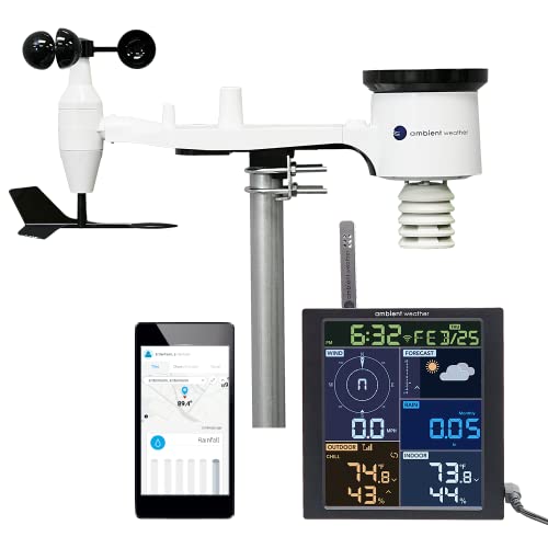
Ambient Weather WS-1965 WiFi Weather Station w/Remote Monitoring and Ambient Weather Network Access
COMPLETE WEATHER STATION: (1) All-in-one Sensor array and (1) Color LCD Display
As an affiliate, we earn on qualifying purchases.
As an affiliate, we earn on qualifying purchases.
Frequently Asked Questions
How Does Humidity Influence Cloud Formation in Stable Air Masses?
Higher humidity levels increase air moisture, which promotes cloud formation even in stable air masses. When humidity is high, the air is nearly saturated, so it requires less lifting or energy to reach the dew point, leading to cloud development. Conversely, low humidity means less moisture, making cloud formation less likely in stable conditions. You’ll notice more clouds forming when humidity levels are elevated, regardless of air mass stability.
Can Unstable Air Masses Produce Persistent Cloud Cover?
Yes, unstable air masses can produce persistent cloud cover, but it’s less common. You’ll find that clouds tend to be more transient in unstable conditions because the atmosphere encourages rapid cloud growth and dispersal. In stable air, clouds often last longer, but in unstable air, they form quickly and may dissipate just as fast, affecting cloud longevity and dispersal patterns considerably.
What Role Do Temperature Gradients Play in Cloud Development?
Temperature gradients play a vital role in cloud development by driving thermal convection, which causes warm air to rise and cool, forming clouds. A strong gradient can lead to vigorous convection, producing towering clouds like cumulonimbus. Conversely, a temperature inversion, where a layer of warm air traps cooler air beneath, suppresses vertical motion, preventing cloud formation. Understanding these gradients helps predict when and where clouds will develop.
How Do Wind Patterns Affect Cloud Growth in Different Air Masses?
You’ll notice that wind patterns, like jet streams, steer air masses and influence cloud growth. Strong winds can lift moist air, encouraging cloud formation, especially when they interact with mountain effects, which force air upward. These patterns can cause rapid cloud development or dispersal, depending on their strength and direction. So, your local weather largely depends on how jet streams and mountain effects shape the movement and stability of air masses.
Are There Specific Weather Conditions That Trigger Cloud Formation Regardless of Stability?
Indeed, precipitation triggers can cause cloud formation regardless of stability, especially during atmospheric convection. When warm, moist air rapidly rises due to surface heating or weather fronts, it cools and condenses into clouds, often leading to precipitation. Think of it as a modern-day alchemy—transforming invisible vapor into visible cloud droplets—making these conditions key in initiating cloud development even when the air mass is stable.

TempPro TP50 Digital Hygrometer Indoor Thermometer Room Thermometer and Humidity Gauge with Temperature Humidity Monitor(Previously ThermoPro)
Wellness Indicator: This humidity meter with humidity level icon indicates air conditions – DRY/COMFORT/WET, allowing this humidity sensor…
As an affiliate, we earn on qualifying purchases.
As an affiliate, we earn on qualifying purchases.
Conclusion
In summary, understanding how air mass stability affects cloud development helps you predict weather patterns more accurately. When air is stable, clouds tend to stay shallow, much like a well-behaved knight in shining armor. But if the air becomes unstable, clouds can grow tall and stormy, just like a rebellious teenager. By keeping an eye on stability, you can better anticipate the skies’ next move, even if it feels like waiting for your favorite TV show’s next episode.

Newentor Weather Station Wireless Indoor Outdoor Thermometer, Color Display Digital Weather Thermometer with Atomic Clock, Barometric Pressure, Forecast Station with Adjustable Backlight, Black
[7.5" LCD Screen Weather Stations] Newentor temperature&humidity monitor with large color display, which shows comprehensive information: inside outside…
As an affiliate, we earn on qualifying purchases.
As an affiliate, we earn on qualifying purchases.

Star Cloud 15X55 UHD Lightweight Binoculars for Adults with Upgraded Phone Adapter, Large View IPX7 Waterproof Binoculars for Bird Watching, Hunting, Hiking, Stargazing (15X55)
Powerful Magnification: 15x magnification brings distant subjects up close with exceptional clarity and detail, making it perfect for…
As an affiliate, we earn on qualifying purchases.
As an affiliate, we earn on qualifying purchases.