
Before reaching the airfield, check the weather forecast for temperature, humidity, and wind patterns, as clear and sunny days usually mean stronger thermals. Observe the sun’s angle — higher in the sky means better thermal development, especially mid-morning to early afternoon. Look for landscape features like dry, sun-exposed ground or hills that can trigger or enhance thermals. Pay attention to wind direction and strength, as gentle breezes aid thermal lift. Keep exploring to find more tips on spotting thermal activity early.
Key Takeaways
- Check weather forecasts for clear, sunny conditions and rising temperature trends indicating strong thermals.
- Observe landscape features like dry, sun-exposed ground and topography that signal potential thermal hotspots.
- Note sun position; higher angles mid-morning to early afternoon typically produce stronger thermals.
- Monitor wind patterns; gentle, steady breezes support thermal development, while gusts may disrupt lift.
- Use real-time data, pilot reports, and satellite imagery to refine thermal activity predictions before arrival.

Have you ever wondered how to gauge the thermal conditions before arriving at the airfield? Understanding the weather patterns and sun positioning can give you valuable insights into the thermal day ahead. Before you even get there, pay attention to the forecast. Look at temperature trends, humidity levels, and wind patterns. Clear, sunny days tend to generate stronger thermals because the sun heats the ground unevenly, creating rising currents of warm air. Conversely, overcast or rainy days usually suppress thermal activity, making flying conditions more stable but less dynamic. By analyzing these weather patterns, you can predict how lively the thermals might be, which is especially useful if you’re planning a cross-country or recreational flight.
Next, consider the sun’s positioning throughout the day. The sun’s angle has a direct effect on thermal development. During the early morning, the sun is low, and thermals are weak or just beginning to form. As the sun climbs higher, typically around mid-morning to early afternoon, the ground heats up more intensely, strengthening the thermals. Keep an eye on the sun’s position relative to the landscape; a high sun angle means more intense surface heating and more vigorous thermal activity. If you’re observing the landscape, look for signs like dry, sun-exposed ground or areas with sparse vegetation—these spots tend to generate stronger thermals because they absorb and radiate heat more effectively. Additionally, local topography can influence how thermals develop, with hills and valleys directing airflow and thermal patterns. Recognizing thermal triggers such as surface features or specific landscape elements can further aid in predicting thermal activity. Understanding environmental factors like soil composition and moisture levels can also impact thermal development, adding another layer to your observations.
You should also consider local weather patterns—how the wind interacts with terrain features. Gentle breezes can help lift thermals and make them more predictable, while gusty winds might disrupt thermal columns, creating turbulence. If you notice a consistent wind direction during the day, it can tell you where thermals are likely to form and rise. For instance, warm air rising from a heated field or hilltop will often drift with the wind, so understanding the wind’s behavior in conjunction with sun positioning can help you anticipate thermal strength and location. Moreover, wind shear can significantly influence the stability and predictability of thermals, making it an important environmental factor to observe. Recognizing how wind patterns behave in relation to terrain can also enhance your thermal prediction skills.
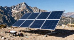
Finally, check real-time weather updates, satellite images, and pilot reports if available. These sources can confirm or refine your predictions, especially regarding cloud cover and wind changes. Combining knowledge of weather patterns with sun positioning allows you to make better-informed decisions about thermal activity. This foresight helps you plan your approach, optimize your flight path, and enjoy a safer, more efficient flying experience. Remember, the more you understand how environmental factors influence thermals, the better you’ll be at reading the sky even before you reach the airfield.

Temtop Multifunctional Weather Station with Indoor/Outdoor Temperature, Humidity, Atmospheric Pressure, Weather Forecast, Moon Phase, and Alarm Features, W100 Lite
All-in-One Weather Tracking: Monitor indoor/outdoor temp (°F), humidity (1-99% RH), and barometric pressure (inHg). Get a precise 12-hour…
As an affiliate, we earn on qualifying purchases.
As an affiliate, we earn on qualifying purchases.
Frequently Asked Questions
How Do Weather Conditions Affect Thermal Readings?
Weather conditions considerably impact thermal readings. Temperature gradients, which are differences in temperature between land and air, create stronger or weaker thermals. Wind influence also plays a role; strong winds can disrupt thermal columns, making them less predictable. When wind is calm, thermals form more steadily, providing better lift for soaring. So, understanding these factors helps you anticipate thermal activity and improve your flying strategy.
What Equipment Is Best for Detecting Thermals?
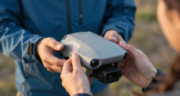
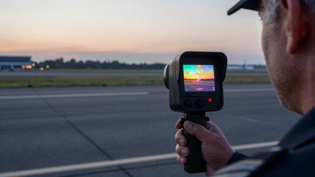
You should use thermal imaging equipment, like a hand-held thermal camera, for detecting thermals effectively. Make sure your device is properly calibrated before use to get accurate readings. Look for consistent, rising warm air pockets on the thermal display, which indicate thermals. Regular calibration and high-quality thermal imaging gear help you identify thermals precisely, making your soaring or gliding experience safer and more efficient.
Can Thermals Vary Throughout the Day?
Sure, thermals can change throughout the day—who would’ve thought? You’ll notice variations in thermal intensity, especially as the sun hits different angles, and altitude influence becomes more noticeable. As the day progresses, thermals often weaken or shift, making them trickier to read. So, stay alert, because what’s strong in the morning might be barely detectable by afternoon, proving that thermal activity loves a good plot twist!
How Accurate Are Thermal Predictions From Forecasts?
Thermal predictions from forecasts can be quite reliable if you understand thermal modeling. These models analyze weather data to estimate thermal activity, but they aren’t perfect due to unpredictable variables like cloud cover or wind shifts. You should consider forecast reliability, especially for precise flying plans. Always use forecasts as a guide and combine them with real-time observations, since actual thermal conditions can differ from predicted ones.
Are There Safety Concerns When Interpreting Thermals?
Think of thermals as hidden currents in a river—powerful but unpredictable. Thermal safety means you stay alert to interpretation hazards that could lead you astray, risking misjudgment. Always cross-check thermal readings with visual cues and weather conditions. Recognizing these hazards helps you navigate safely, ensuring your flight remains smooth and secure. Trust your training, stay cautious, and respect the thermal’s silent, shifting nature.

HF96 Thermal Camera with Laser Pointer, Intelligent Scene Detection, Super Resolution 240 x 240, -4°F~1022°F, Thermal Imaging Camera 96 x 96 IR Resolution, 25 HZ Infrared Camera, 11h Runtime
【Intelligent Scene Recognition with IntellFault】HF96 features HSFTOOLS' unique IntellFault technology for automated scene detection. Powered by deep learning,…
As an affiliate, we earn on qualifying purchases.
As an affiliate, we earn on qualifying purchases.
Conclusion
By understanding how to read a thermal day before reaching the airfield, you gain a essential edge in soaring. Remember, thermal activity can vary markedly—studies show that experienced pilots can find up to 30% more lift by interpreting subtle cues early. With these insights, you’ll boost your confidence and efficiency in the air. So, next time you prepare for a flight, trust your observations and embrace the thermal day ahead—your soaring success depends on it.
thermal lift prediction equipment
As an affiliate, we earn on qualifying purchases.
As an affiliate, we earn on qualifying purchases.

Jeppesen Aviation Weather
Used Book in Good Condition
As an affiliate, we earn on qualifying purchases.
As an affiliate, we earn on qualifying purchases.